Elkhorn River at West Point, Nebr.
Cuming County, Nebraska · USGS 06799350
Updated Sep 24, 9:45 AM CDT
How to read these numbers
How much water moves past the gauge each second. Higher numbers mean more water is moving downstream.
The water-surface height at this gauge. It is useful for tracking rises, falls and flood thresholds, but it is not the river's total depth.
How much the latest reading has risen or fallen compared with roughly 24 hours earlier.
The typical streamflow for this date based on USGS historical statistics. A multiple such as 3× means current flow is about three times the historical median.
Get Water Data's plain-language summary of current flow, historical context and recent direction.
Official action and flood thresholds where available. These levels are specific to each gauge location.
Gauge height and flood stage are station-specific. A 12-foot reading at one gauge should not be directly compared with 12 feet at another.
Read the full beginner guide →Current conditions · Rising
Streamflow is currently 424 ft³/s. Flow has risen 15 CFS over the past 24 hours.
Streamflow trend
About this gauge
Official USGS station
Get Water Data organizes provisional public monitoring data from the U.S. Geological Survey.
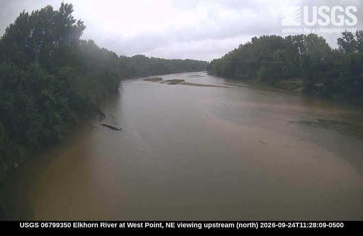
View USGS station →Latest USGS river camera
Recent imagery from the U.S. Geological Survey.
SHARE & EMBEDShare live water conditions
Compact live badge
A lightweight image that links back to this gauge page and stays updated with current USGS data.